


Indoor Mapping
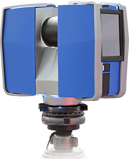
Terrestrial LiDAR
Acquire, Analyse and Apply - Enhancing problem solving with data-driven insights
Acquire, Analyse and Apply - Enhancing problem solving with data-driven insights
Terrestrial LiDar provides precise and extensive 3-D structural information of the surface at any elevation. This geo-spatial data collected plays a critical role in infrastructure, river management, highway construction, etc. For many real world problems, finding an effective solution might be time-consuming. But using terrestrial LiDAR technology solves the issue as the data collected helps in coming up with practical solutions for crucial problems.
High accuracy topographical data represented in 3D models is possible with the help of terrestrial LiDAR. An in-built scanner releases Laser pulses to capture the XYZ data points along with precise imaging. Multiple industries utilize the detail-intensive information to solve many practical problems that boost businesses.
Information from terrestrial LiDAR can be used for improving urban planning, identifying encroachment or illegal construction, managing roads, drainage management, river rejuvenation and many more with efficient solutions implemented quickly.
At Geokno, LiDAR scanned data is collated, represented as cloud points in XYZ plane and laser images are analysed by our team and help our clients enhance their work with efficient decision making. Indoor mapping, narrow street scanning, infrastructure information and civil engineering aid in mapping and visualizing data in a 3-D model. The repository of detail-intensive data captured on topography is documented after multiple rounds of strict review by our team.
Range from 0.6 m to 350 m
Data accuracy up to 0.5 mm
HD photo overlay up to 165 megapixel
Indoor Mapping
Narrow Street Mapping
Architectural Engineering Model
Building Information Model
Structural Analysis & Progress Monitoring in Construction Industry
Heritage Documentation
Inspection & Reverse Engineering
Civil Engineering and Surveying


